
![]()
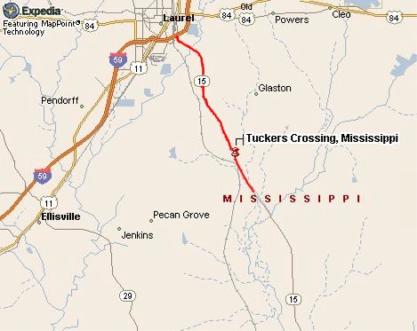
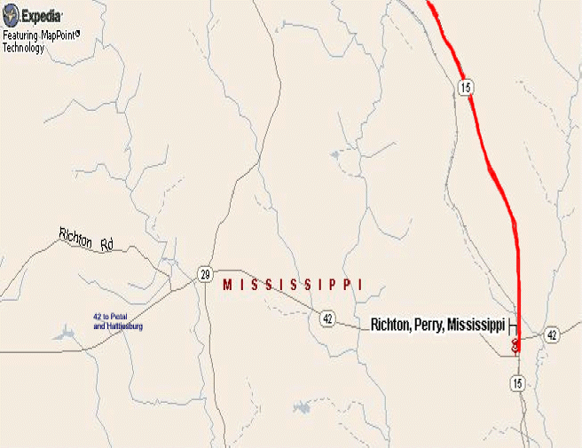
If you are coming from Laurel or north (of Laurel), or
anywhere south of Laurel
From the north (Laurel and points north):
Take the Highway 15 south exit (Cook Avenue, exit 96B) off I 59 and go
south
on Highway 15 for 7.9 miles, (3 miles past the cross road at Tucker's
Crossing).
Allow one half hour from Laurel to the start/finish line.
|
2019 and 2020 Disregard the instructions below to turn on George Boutwell. FSR 201 is impassable due to logging. Continue south on Hwy 15 for another ~5 miles and follow the instructions below for coming from the south. You will turn slight left on FSR270 and then the next left on FSR 213 will take you to the campground. See map. Turn left onto George Boutwell Road at the National Forest sign that says Longleaf Horse Trail. There will also be a race day sign here and at all turns from here on. Beware of sharp curves, slippery when wet. Go 1.8 miles and turn right on a dirt road, Forest Service Road (FSR) #201. |
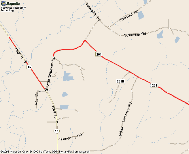
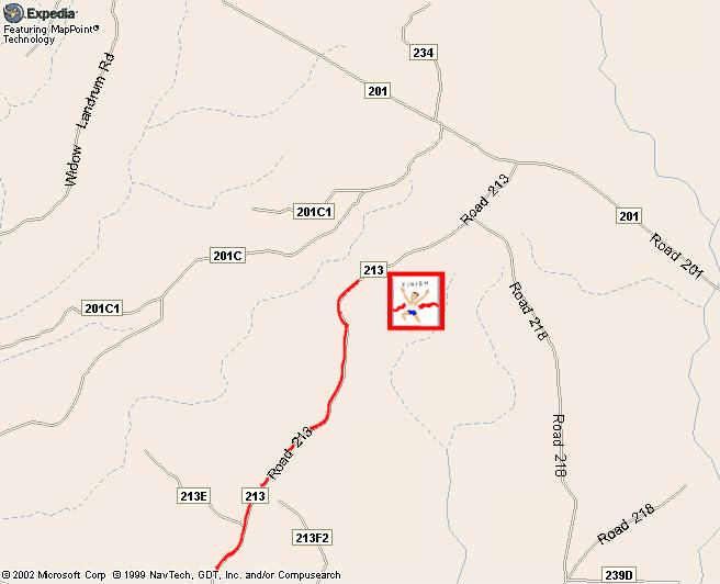
Go 4.3 miles and turn right at the campground sign onto
FSR #213.
Go .5 miles to the entrance to the campground (start/finish).
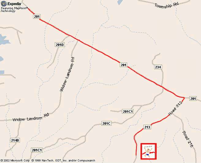
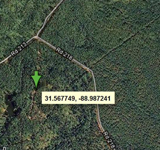
N31 34 00.07 W88 59 15.0
From the south: |
Turn right at the national forest sign on dirt road FSR #270. The turn onto
FR270
is a very sharp135 degrees to the right and is easy to miss.There will also
be a race day
sign here and at all turns from here on. After .4 (4 tenths) miles turn left on dirt
road FSR #213.
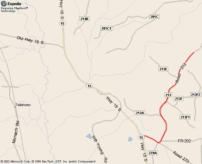
Go 4.5 miles on FSR #213 to the campground (start/finish) entrance.
![]()